Within SVG UFO Files
Why Caribbean Skies Distort Distance and Scale
Wide horizons and scattered islands make distant meteors, satellites and rocket plumes easy to see but difficult to place accurately.
On this page
- Wide maritime horizons across the Grenadines
- Why distant objects appear to fall nearby
- What multi island reports reveal about altitude
Page outline Jump by section
Introduction
Saint Vincent and the Grenadines offers some of the clearest long-distance views in the eastern Caribbean, but those same conditions can make unusual aerial events difficult to judge accurately. The country’s chain of volcanic islands, broad sea channels and unobstructed horizons allow meteors, satellites, rocket re-entries and other high-altitude phenomena to remain visible over great distances. As a result, objects that are actually tens or even hundreds of kilometres away can appear to descend just beyond a neighbouring island or into nearby waters. This geographical effect helps explain why several of the country’s best-known UFO reports have later proved consistent with conventional astronomical or aerospace events, while a small number have remained unidentified simply because precise observational data were unavailable rather than because they displayed extraordinary characteristics.[searchlight.vc]searchlight.vcWe didn’t find anything to say it was or wasn’t a meteorite – CoastguardJuly 31, 2014…
Why Caribbean skies distort distance and scale
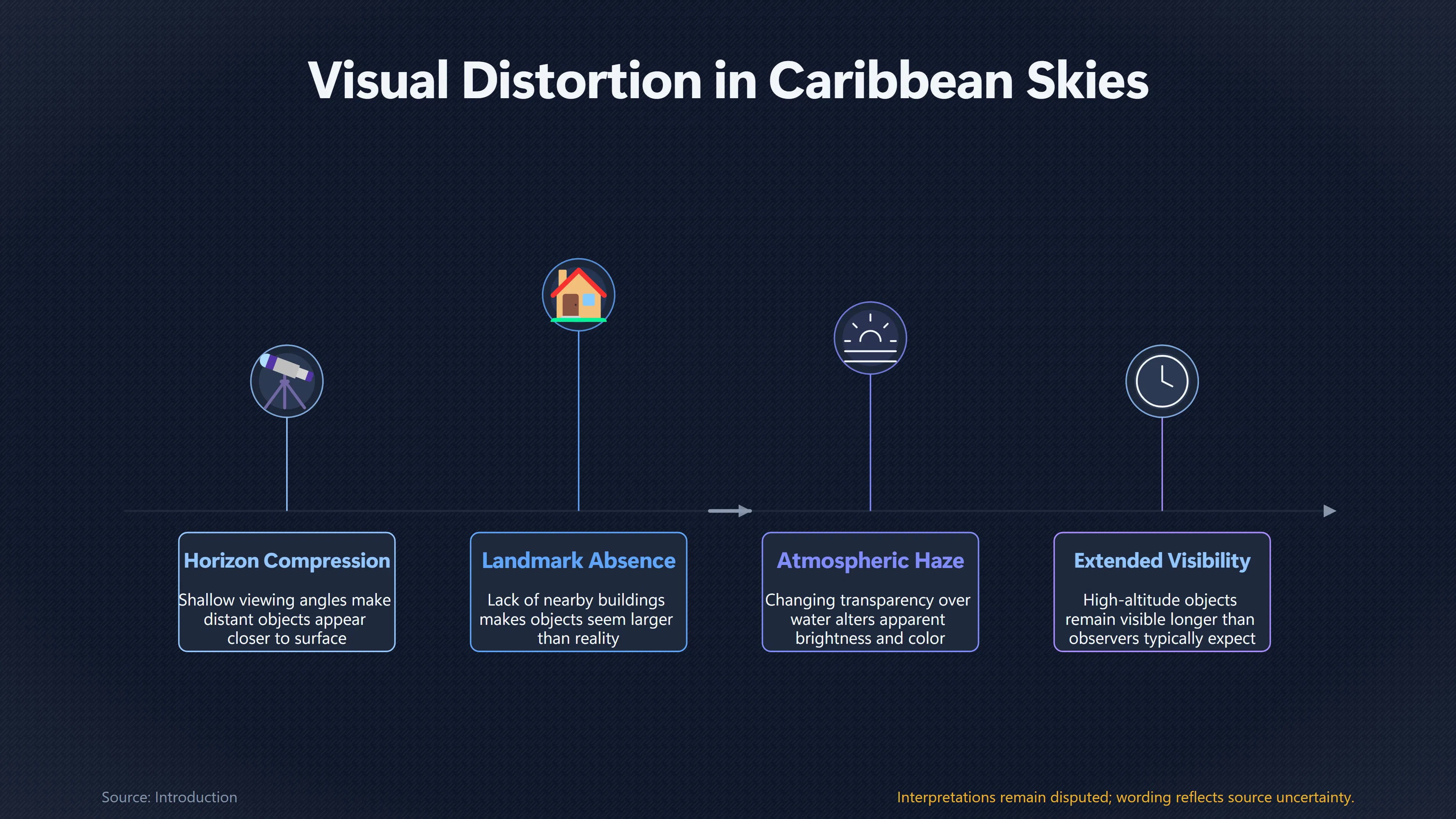
Saint Vincent and the Grenadines differs from many inland locations because almost every populated island overlooks wide expanses of open ocean. Without mountains, buildings or forests extending across the horizon, observers lose many of the visual cues that normally help estimate an object’s distance, altitude and speed.
Human vision relies heavily on reference points. Over the sea:
- Bright objects appear larger than they really are because there are few nearby landmarks for comparison.
- A shallow viewing angle near the horizon compresses perspective, making distant objects seem much closer to the surface.
- Atmospheric haze and changing transparency over water can alter apparent brightness and colour.
- High-altitude objects may remain visible for much longer than observers expect, encouraging the impression that they are travelling at relatively low altitude.
These effects are well understood in observational astronomy and satellite tracking. Low-Earth-orbit satellites and fireballs can remain visible across enormous areas when they are illuminated by the Sun while the ground below is already in darkness.[eso.org]eso.orgOpen source on eso.org.
Wide maritime horizons across the Grenadines
The Grenadines are separated by numerous sea passages rather than continuous land. A person on Bequia, Mustique, Canouan or mainland Saint Vincent may therefore witness the same luminous event from very different viewing angles while each observer naturally assumes it occurred close to their own location.
This geographic arrangement produces several recurring patterns:
- A meteor passing high above the Caribbean can appear to descend behind a nearby island even though it actually burns up far offshore.
- Satellite re-entries may seem to cross directly over individual islands while remaining hundreds of kilometres above Earth.
- Reports from multiple islands often describe different apparent directions despite referring to the same object, because each viewing position changes the perceived trajectory.
Rather than indicating multiple independent phenomena, these differing accounts frequently reflect simple geometric perspective. When investigators reconstruct such events, broad geographic visibility generally suggests a high-altitude source instead of a low-flying object.[searchlight.vc]searchlight.vcWe didn’t find anything to say it was or wasn’t a meteorite – CoastguardJuly 31, 2014…
Why distant objects appear to fall nearby
The 24 July 2014 fireball remains the clearest illustration of this perceptual problem within Saint Vincent and the Grenadines.
Residents on Bequia, Mustique and mainland Saint Vincent described a flaming object moving rapidly across the evening sky. Early rumours suggested an aircraft had crashed into nearby waters because many witnesses believed the object descended locally. Air traffic authorities quickly confirmed that no aircraft were missing, and a Coast Guard search found neither wreckage nor impact evidence. Officials subsequently stated that they could neither confirm nor rule out a meteorite because nothing had been recovered.[searchlight.vc]searchlight.vcWe didn’t find anything to say it was or wasn’t a meteorite – CoastguardJuly 31, 2014…
The event demonstrates an important principle in interpreting UFO reports over island environments. A bright meteor can appear to terminate just beyond the horizon even when it actually extinguishes at an altitude of many tens of kilometres. Without multiple calibrated photographs, radar tracks or recovered fragments, eyewitnesses alone cannot reliably distinguish between:
- an object burning up high in the atmosphere;
- a controlled spacecraft re-entry;
- fragmentation of orbital debris; or
- an actual impact into the sea.
Consequently, an apparently nearby descent should not be treated as evidence that an object reached the surface.
What multi-island reports reveal about altitude
One of the strongest clues available in Saint Vincent and the Grenadines is whether reports originate from several islands simultaneously.
Objects visible across much of the island chain are generally more consistent with considerable altitude than with low-level flight. A meteor or satellite at high elevation can be observed by people separated by many kilometres, whereas a genuinely low-flying object would normally disappear behind terrain or fall below neighbouring horizons much sooner.
The country’s documented incidents support this interpretation. The 2014 fireball generated reports from several islands without producing confirmed debris, while later widely reported satellite displays—including Starlink satellite trains and other orbital phenomena visible across the Caribbean—were also observed over broad regions rather than isolated localities. Their extensive visibility reflected orbital geometry rather than unusual manoeuvring.[searchlight.vc]searchlight.vcWe didn’t find anything to say it was or wasn’t a meteorite – CoastguardJuly 31, 2014…
This geographical pattern provides investigators with a practical indicator:
- Single-location observation: harder to interpret because perspective cannot be compared.
- Multi-island observation: often indicates a distant, high-altitude phenomenon visible over a wide area.
- Independent instrumental confirmation: remains far more valuable than eyewitness estimates of distance or altitude.
Island geography and the changing nature of UFO reports
Modern satellite constellations have added a new source of misidentification to an environment already prone to perspective errors.
Recently launched Starlink satellites often appear as evenly spaced moving lights shortly after sunset or before sunrise, when they remain sunlit against a dark sky. Because Saint Vincent and the Grenadines enjoys extensive western and eastern sea horizons with relatively little light pollution outside Kingstown, such formations can be unusually conspicuous. Their unfamiliar appearance has generated UFO reports worldwide, including across the Caribbean, despite matching predictable orbital behaviour.[wikipedia.org]WikipediaSatellite flareSatellite flare
The combination of clear maritime horizons and increasing human activity in low Earth orbit means that residents today are likely to encounter more striking aerial displays than previous generations, even though most have conventional explanations.
What this means for interpreting Vincentian UFO reports
Island geography does not create unidentified aerial phenomena, but it does shape how they are perceived. In Saint Vincent and the Grenadines, wide ocean views increase the likelihood that observers will notice distant astronomical and aerospace events while simultaneously reducing their ability to estimate where those events actually occurred.
This helps explain why the country’s publicly documented UFO history contains relatively few enduring mysteries. The available cases are better understood as examples of how geography influences perception: distant objects can appear local, bright objects can seem larger than they are, and multiple islands may witness the same event from different perspectives without implying multiple objects. For this reason, investigators give greater weight to trajectory reconstruction, timing, independent observations and physical evidence than to eyewitness estimates of distance alone.
Amazon book picks
Further Reading
Books and field guides related to Why Caribbean Skies Distort Distance and Scale. Use these as the next step if you want deeper reading beyond the article.
The Demon-Haunted World: Science as a Candle in the Dark
Teaches critical thinking about extraordinary claims.
NightWatch: A Practical Guide to Viewing the Universe
Helps identify ordinary sky phenomena.
eBay marketplace picks
Marketplace Samples
Live-tested eBay searches with available results related to this page.
Selected fromCaribbean wall art oneBay.co.uk.


Endnotes
1.
Source: searchlight.vc
Title: We didn’t find anything to say it was or wasn’t a meteorite – Coastguard
Link:https://www.searchlight.vc/news/2014/07/31/we-didnt-find-anything-to-say-it-was-or-wasnt-a-meteorite-coastguard/
Source snippet
July 31, 2014...
Published: July 31, 2014
2.
Source: earthsky.org
Title: Starlink satellite disintegrates over the Caribbean
Link:https://earthsky.org/space/starlink-satellite-disintegrates-caribbean-puerto-rico/
3.
Source: arxiv.org
Link:https://arxiv.org/abs/2003.07446
4.
Source: Wikipedia
Title: Satellite flare
Link:https://en.wikipedia.org/wiki/Satellite_flare
5.
Source: arxiv.org
Link:https://arxiv.org/abs/2003.07805
6.
Source: arxiv.org
Title: arXiv Starlink Mini Satellite Brightness Distributions Across the Sky
Link:https://arxiv.org/abs/2401.01546
7.
Source: starlink.com
Link:https://starlink.com/us/updates
Source snippet
Image SPACE SAFETY WEB TOOL May 21, 2026 To ensure safe spaceflight for everyone, all satellite operators should track their space...
Published: May 21, 2026
8.
Source: nature.com
Title: Satellite megaconstellations will threaten space-based astronomy | Nature
Link:https://www.nature.com/articles/s41586-025-09759-5
9.
Source: space-safety.starlink.com
Title: constellation altitudes
Link:https://space-safety.starlink.com/docs/space-safety-articles/constellation_altitudes/
10.
Source: docs.space-safety.starlink.com
Link:https://docs.space-safety.starlink.com/docs/tutorial-basics/stargaze/
11.
Source: starlink.com
Link:https://starlink.com/ke/updates/stargaze
12.
Source: iwnsvg.com
Title: i Witness News Meteorite triggers plane crash fears in Bequia – i Witness News
Link:https://www.iwnsvg.com/2014/07/25/meteorite-triggers-plane-crash-fears-in-bequia/
13.
Source: eso.org
Link:https://www.eso.org/~ohainaut/satellites/
14.
Source: fireballs.imo.net
Link:https://fireballs.imo.net/imo_view/event/2014/543
15.
Source: fireball.amsmeteors.org
Link:https://fireball.amsmeteors.org/imo_view/event/2014/290
16.
Source: fireball.amsmeteors.org
Link:https://fireball.amsmeteors.org/imo_view/event/2014/139
17.
Source: imo.net
Link:https://www.imo.net/observations/fireballs/fireballs/
18.
Source: hero.epa.gov
Link:https://hero.epa.gov/reference/5386658/
Additional References
19.
Source: satspeedcheck.com
Title: Starlink Satellite Train Tracker: How to Spot It
Link:https://satspeedcheck.com/blog/starlink-satellite-train-tracker/
Source snippet
May 5, 2026 — STARLINK SATELLITE TRAIN TRACKER: HOW TO SPOT IT May 5, 2026 SatSpeedCheck Team 12 min read QUICK ANSWER: A visible Starlin...
Published: May 5, 2026
20.
Source: youtube.com
Title: The Physics of Mirrored Horizons: Why the Atmosphere Behaves Like a Lens
Link:https://www.youtube.com/watch?v=8yCBqjLyQ8g
Source snippet
The moon illusion - Andrew Vanden Heuvel...
21.
Source: astroexplorer.org
Link:https://www.astroexplorer.org/details/apjlab8016f7
22.
Source: frontiersin.org
Link:https://www.frontiersin.org/journals/earth-science/articles/10.3389/feart.2018.00042/full
23.
Source: youtube.com
Title: How Do We Measure Distance In The Universe?
Link:https://www.youtube.com/watch?v=moiSQ-Gc5pg
Source snippet
Starlink Satellites Mistaken As UFOs Over Pittsburgh...
24.
Source: research-portal.uea.ac.uk
Link:https://research-portal.uea.ac.uk/en/publications/whose-reality-counts-factors-affecting-the-perception-of-volcanic/
25.
Source: research-portal.uea.ac.uk
Title: uea.ac.uk The dilemmas of risk-sensitive development on a small volcanic island
Link:https://research-portal.uea.ac.uk/en/publications/the-dilemmas-of-risk-sensitive-development-on-a-small-volcanic-is/
26.
Source: youtube.com
Title: The moon illusion
Link:https://www.youtube.com/watch?v=RXkYjL_7jME
Source snippet
How Do We Measure Distance In The Universe?...
27.
Source: ukmeteornetwork.co.uk
Title: full report on fireball spotted over england on 15 february 2014 at 183020
Link:https://ukmeteornetwork.co.uk/2014/02/full-report-on-fireball-spotted-over-england-on-15-february-2014-at-183020/
Published: february 2014
28.
Source: sciencedirect.com
Title: Whose reality counts? Factors affecting the perception of volcanic risk
Link:https://www.sciencedirect.com/science/article/abs/pii/S0377027307004180